Home / Software
Software · Command & Fleet
One platform to plan, fly and command your entire fleet — live ISR on the ground and full fleet control in the cloud, encrypted end‑to‑end over 5G.
Overview
The DroneAI Cloud Control Solution unifies the operator's ground command post and the cloud fleet layer into a single system. On the ground, it's a full-stack ISR console; in the cloud, it's the layer that ties every machine together — so one screen runs a mission and one console runs the fleet.
The result is one browser view for the whole operation — live ISR on the ground, the entire fleet in the cloud, and a secure path to every machine in between. The sections below break down what that looks like, mode by mode.
It's built on proven foundations — ArduPilot, MongoDB and Cesium — validated on real edge-AI hardware, and runs over private 5G networks delivered with partners such as BSNL, Netar and Echelon.
On the ground
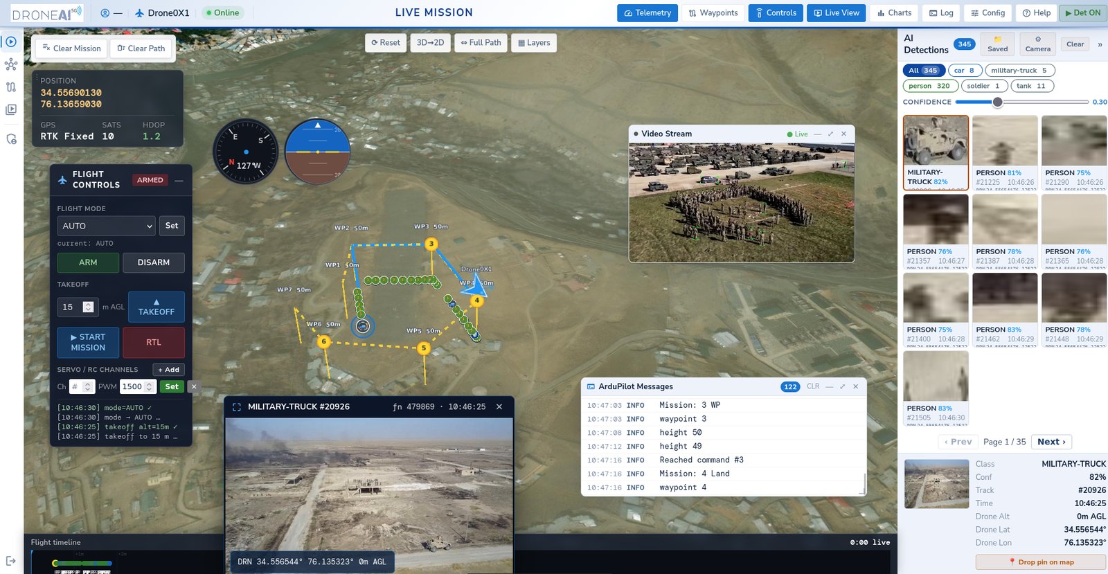
Real-time telemetry, 3D map and live video with AI-detection overlay and class chips.
Build waypoint missions on a 3D globe with live terrain and a waypoint table.
Play back any flight with flight path, mission events and recorded video feeds.
In the cloud
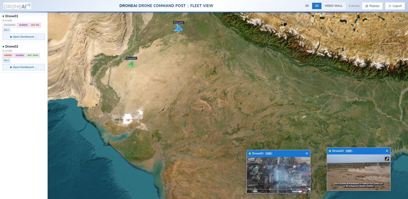
Every drone, rover and vessel on one live map with aggregated AI detections.
Command over encrypted 5G with automatic link failover to Starlink.
Reach any device remotely for updates, config and diagnostics.
Proven in the field
Already in operational ISR use with defence forces — planning, flying and commanding real missions in the field.
DroneAI Cloud · Command & Control
Plan, fly and command drones, rovers and vessels from a single console — a live map, video and geotagged AI detections in one view, with beyond‑line‑of‑sight control over encrypted 5G.
Cloud
Click a view to open it on the console.
Why DroneAI
The kit mounts beside the autopilot on one cable. Nothing is removed and nothing is retrained: the pilot keeps the radio, and the commander gets AI alerts and live video over 5G.
How we start
Start small on your own drones, prove it in your sector, then roll it out.
We fly a DroneAI-equipped drone over 5G with live video, AI detections and C2 on screen.
The kit goes on drones you already operate — telemetry, Ethernet, 5 V power and a SIM.
DroneAI Studio adds the classes your sector needs, from your own footage, on your servers.
Pilot, commander and headquarters on one C2 picture, with replay and reports for every sortie.
Proven in the field
Edge AI detection of persons and vehicles with geo-tagged alerts to the command post; every sortie saved and searchable.
Drones and dumper trucks on one private 5G network and one dashboard — aerial video, LiDAR and truck telemetry together.
Live 5G flights and AI demos for forces, telecom operators and industry. See the events
Questions buyers ask
Yes. DroneAI C2 is hosted on DroneAI cloud or on your own servers, with encrypted video, telemetry and detections.
Yes — MAVLink drones (ArduPilot, PX4) and RTSP cameras, plus rovers and boats on the same map.
The pilot sees live video, AI boxes and flight controls on the tablet; the commander sees every drone and alert of the unit; headquarters sees the picture across units, with replay and reports.
Every sortie is recorded: video, track, detections and logs, with mission replay and area reports for any 1 km as PDF.
AI models and firmware are updated over the air, with rollback.
With a 5G flight demo, then a field trial on your own drones. Use the contact page or call +91 98866 91115.